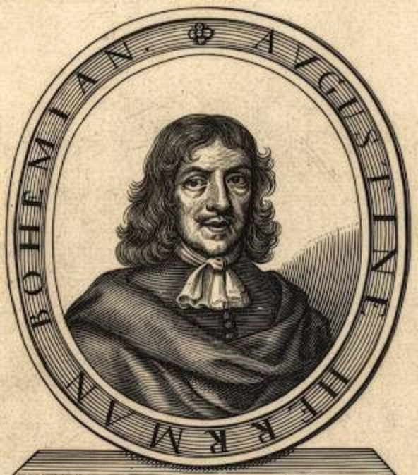
A 1673 self-portrait engraving of Augustine Herman.
Augustine Herrman (1621-1697)
(Alternative spelling=Hermann)
Augustine Herrman became the first naturalized citizen of Maryland by order of Cecil Calvert, Second Lord Baltimore. Herrman became famous by drawing the first accurate map of the Chesapeake Bay, which he presented to Lord Baltimore in 1670. Many people living in England first learned what Maryland looked like from the engraving of Herrman's map.
Augustine Herrman was born in Prague, a city in the eastern European country of Bohemia (now called the Czech Republic). In the 1620s, Herrman’s family left Bohemia and moved to the Netherlands. Later, he sailed to the Dutch colony of New Amsterdam, located on the site of present-day New York City.
Augustine Herrman first came to Maryland as an ambassador in 1659. New Amsterdam's governor, Peter Stuyvesant, sent Herrman and fellow ambassador Resolved Waldron, along with a few soldiers and native guides, to clear up land disputes on the Eastern Shore. At the time, English colonists, Dutch colonists, and the Nanticoke people all claimed land along the Delaware Bay, on the northeast coast of the Eastern Shore, and fought each other for control of it. Herrman and Waldron then met with Maryland's leaders in St. Mary’s City to settle the dispute between Maryland and the Dutch settlements, though the Nanticokes were left out of the discussion.
Herrman saw much of the Maryland colony on his journey and admired the territory. He traveled south to Virginia before returning to New Amsterdam. These experiences allowed him to see much of the Chesapeake Bay area, which would aid him in drawing his map in the future.
In 1660, Herrman returned to Maryland along with his family. Maryland governor Phillip Calvert and the Maryland Council gave him limited citizenship rights in January of the following year. Herman proposed to Cecil Calvert that he would draw an accurate map of the colony in exchange for ownership of land where he could build a manor house.
Cecil Calvert agreed, and in addition to other privileges offered, gave him permission to purchase 4,000 acres of land from the Susquehannock people on the Eastern Shore in what is now Cecil County. Herrman named his new property "Bohemia Manor," after the country of his birth. In 1663, the Maryland Assembly signed a petition naming Herrman and his family naturalized citizens of Maryland. He became a plantation owner who was respected by his community and held numerous county offices.
Herrman spent about ten years charting the Maryland and Virginia colonies. He used this information to draw what was then the most accurate map of the Chesapeake Bay coastline. A London publisher printed engravings of his map beginning in 1673. Augustine Herrman died a wealthy man, and his son Casparius inherited 25,000 acres of land.
« Back to Library Collection
Sources:
Maryland State Archives. (n.d.). Casparus Augustine Herman file [Son of Augustine Herrman] (Biographical Series). MSA SC 3520-642.
Papenfuse, E. C., Day, A. F., Jordan, D. W., & Stiverson, G. A. (1979–1985). A biographical dictionary of the Maryland legislature, 1635–1789 (Vols. 1–2). Johns Hopkins University Press.
Scharf, J. T. (1967). History of Maryland from the earliest period to the present day (Vols. 1–3). Tradition Press. (Original work published 1879)